Path of the 2026 August 12th Total Solar Eclipse (P) |
|
The position of the umbral shadow path across Russia, Greenland, Iceland, Spain and Portugal has been accurately determined and is now available via the link given further below. Most notably, this path incorporates adjustments that account for the topographic elevation, both around the limb of the Moon and on the surface of the Earth. It therefore provides a reliable guide for intrepid observers who may wish to venture close to the path limits and witness prolonged, and potentially profound, edge effects around the time of maximum eclipse.
|
|
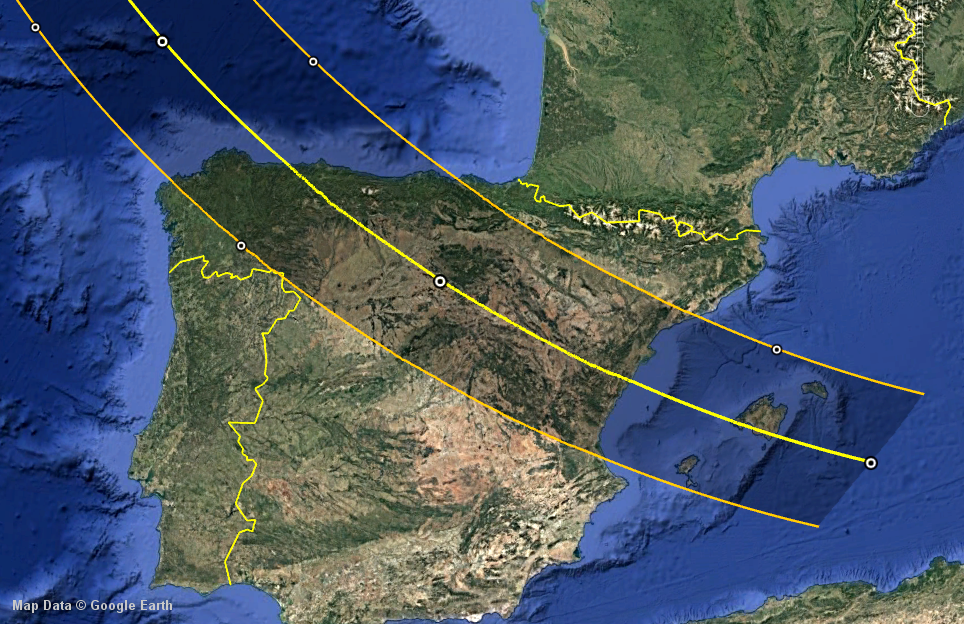
The link provides access to a KML file which can be viewed in Google Earth. The cropped screen-grab image below (left) depicts how the path appears on initial loading, showing the end of the path over northern Spain & Portugal, together with the central line and timing markers.
|
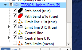
| Path band (true) |
Shaded area between the true-limb path limits. |
| Path band ±1σ (true) |
Shaded area on each side of the path showing the variation in the across-path position of the true-limb limit line due to the uncertainty in the eclipse solar radius (±0.05" at one au). |
| Limit line ±1σ (true) |
Lines bounding the uncertainty zone on each true-limb path limit. |
| Limit line UTC (true) |
Times of maximum true-limb eclipse at 1-minute intervals. |
| Central line |
Trace of the intersection between the shadow axis and the surface of the Earth. |
| Central line UTC |
Times of maximum central eclipse at 5-minute intervals. |
| Path limits (mean) |
The mean-limb path limits, corresponding to the mean lunar radius. |
|
Note that the uncertainty zones should be avoided by observers hoping to catch totality from a location close to the path limits. There is no guarantee that complete obscuration of the Sun will be seen from there, although if totality is achieved it will last only a few seconds at most. It is recommended that observers position themselves a few hundred metres inside the true-limb path limits to witness totality with a significantly longer duration. |
|
By definition, the duration of the eclipse on either the true-limb or the mean-limb limit lines is zero, corresponding to simultaneous second and third contacts at the time of maximum eclipse. However, it must be emphasized that, on the mean-limb path limits, no such events exist in reality as the lunar mean limb is not an observable quantity. Only true-limb-based data has any connection with what could be seen in the sky at the time of the eclipse.
|
|
Despite this, the mean-limb path limits come in handy when they are used with the corresponding true-limb limits to define a so-called "graze zone". This zone can be a few kilometres wide and usually lies exterior to the true-limb limits. This is certainly the case for TSE2026 on both path limits, wherein observers will miss-out on totality but still see a great deal of limb activity from Baily's beads (a veritable broken total eclipse).
|
|
The mean-limb path limits are also useful in providing clear definitions of broken eclipses, especially in the region of the transition point of a hydrid eclipse. This is covered in more detail in True Umbral and Antumbral Surfaces of the Lunar Shadow and Mapping the Broken Solar Eclipse.
|
| Planetary ephemeris |
JPL/DE440. |
| Astrometric method |
Light-time + gravitational light deflection + planetary aberration. |
| Astrometric origin |
Hybrid (topocentric & geocentric). |
| Earth orientation model |
IAU2006A-EQX + EOP (TTUT1 = +69.1840 s). |
| Earth orientation parameters |
TAIUTC = +37 s, UT1UTC = +0.0000 s, polar motion = (+0.000, +0.000)". |
| Moon orientation model |
ME421 (relative to PA440). |
| Mean solar radius |
(696221 ± 36) km or (959.95 ± 0.05)" at one au. |
| Mean lunar radius |
1738.091 km. |
| Terrestrial radii |
6378.137 km, 6356.752 km (WGS84). |
| Lunar DEM |
SLDEM2015/LDEM128 (256/128 pixels per degree). |
| Terrestrial DEM |
SRTM3 (1200 pixels per degree) + EGM96 geoid undulation. |
| Software |
EclipseView, LimbView & SkyWare (proprietary). |